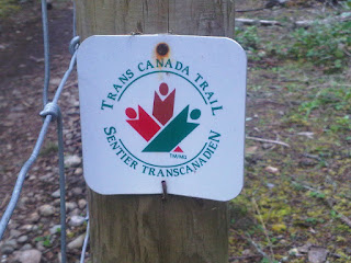
Part of the Trans Canada Trail (for those who do not know, the Trans Canada Trail is the world's longest network of trails. When completed, the Trail will stretch 22,000 kilometers from the Atlantic to the Pacific to the Arctic Oceans, linking 1000 communities and 33 million Canadians. Today more than 16,500 kilometers of trail have been developed.)
Happy to be hiking again (ignore the dark bags under my eyes)
Not far into the hike
After just under 1km of hiking, I came to the Haslam Suspension Bridge. I have lived in Nanaimo my entire life (except 2 years I spent in Australia) and yet I have NEVER been here before. Unbelievable!
Photo Op!
Bridge info!
Map of where I was going to hike. I complete about 1/3 of the trail, almost reaching Spruston Road (first horizontal black line near McKay Lake).
After the suspension bridge, a lot of the hike is on back roads like this.
After a short steep incline, I found myself looking out over some clear cut areas =(
More back roads. Honestly I was a bit disappointed as it was very open and boring.
Still on track!
I reached Timerbland Lake!
Which is apparently popular with people on quads. Fire anyone?
Another photo op!
Haslam Trail changes to White Pine Trail. Just before this I ran into the only person I ever saw (a lady with her little dog).
Heading up into the bushes!
It was honestly a little scary being in what seemed like the middle of nowhere alone; however, I was cautious and paid attention to my surroundings! Never saw any animals, not sure if they saw me though?!
Finally some trails!
I tried to reach Spruston Road; however, after 65 minutes I had no idea how close I was to the road, so I turned back. This photo looks back towards the forrest area where I just was.
Can't complete a West Coast Hike without this stuff!
Heading back down the steep embankment towards Haslam Creek
Looking back up the way I just came
Last trail before the bridge.
I kind of hiked/ran part of the way back, completing the hike in just over 2 hours. It was a good hike. Although it is not very scenic like previous hikes, you definitely have the ability to walk for hours.


1 comment:
GPS on your smartphone works wonders when out on a hike. Trust me, it got me out of being lost, lol .
Post a Comment